Lost Gulch Overlook
Panoramic Views of Indian Peaks Wilderness from Flagstaff Road
Lost Gulch Overlook is one of the most accessible scenic viewpoints in Boulder, Colorado. Located along Flagstaff Road, this rocky overlook offers sweeping views of the Indian Peaks Wilderness and the northern Front Range.
From downtown Boulder, it takes about 20 minutes by car to reach this alpine-like landscape.
🔎 Boulder Trail Index (All Trails)
Basic Information
Official site: Lost Gulch Overlook (City of Boulder)
Official map: OSMP Trail Map (City of Boulder)
Location: North side of Flagstaff Road, Boulder, Colorado
(📍 Link to Google Maps)
Managing Agency: City of Boulder Open Space and Mountain Parks (OSMP)
Access: Short walk from parking lot (1–2 minutes)
Best Time to Visit: Sunrise, sunset, clear winter mornings
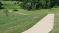
Lost Gulch is not a traditional long hiking trail. The main overlook is reached almost immediately from the parking area, making it one of the easiest high-elevation viewpoints near Boulder.
Trailhead & Parking
A relatively large parking lot is located on the north side of Flagstaff Road.
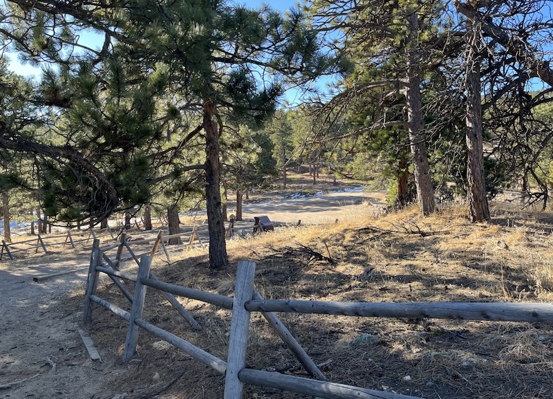
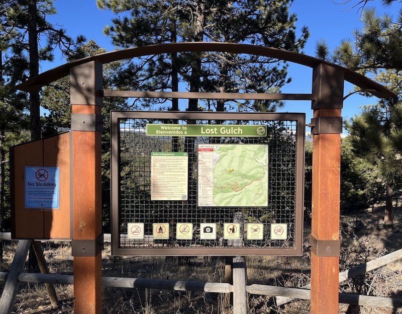
A trailhead sign is posted near the lot. From there, it takes only a minute or two to reach the rocky overlook area.
There is also a short trail (approximately 0.1 miles) heading southwest for slightly different viewing angles.
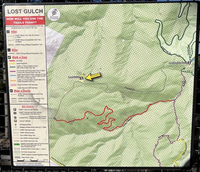
⚠️ Flagstaff Road is narrow and winding. Drive carefully, especially in winter conditions.
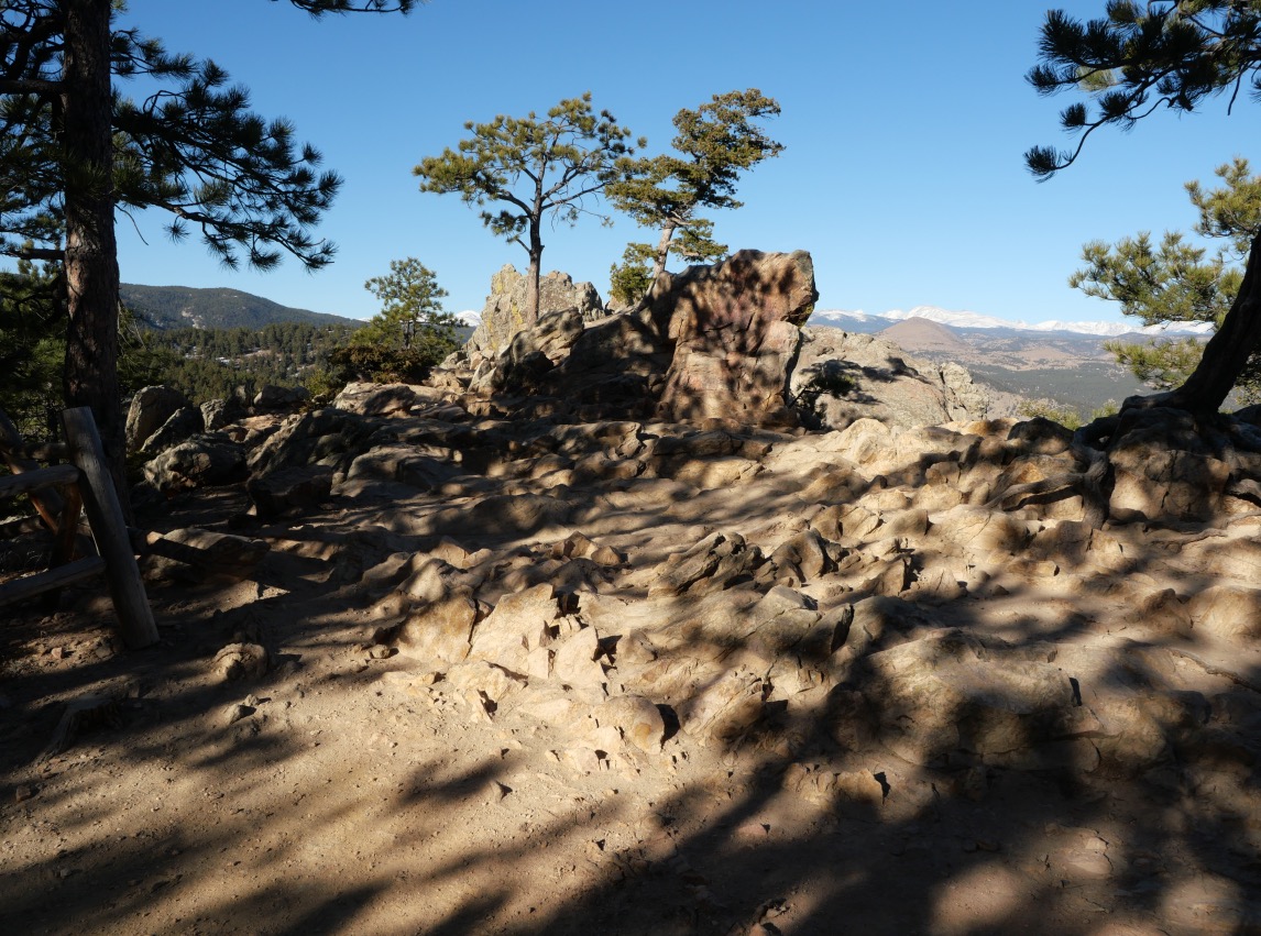
Views from Lost Gulch
From the rocky outcrop, you can see much of the Indian Peaks Wilderness.

Southern (Left) Skyline
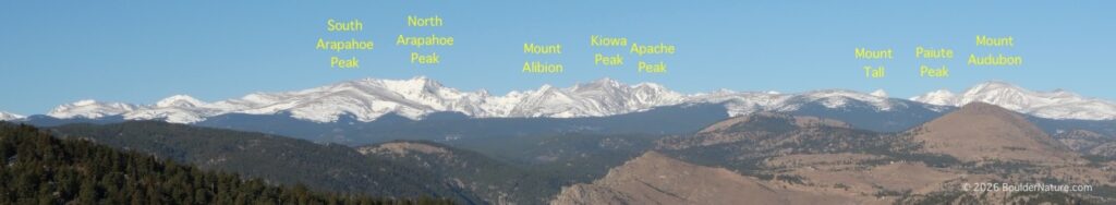
- South Arapahoe Peak
- North Arapahoe Peak
- Mount Albion
- Kiowa Peak
- Apache Peak
- Mount Toll
- Paiute Peak
- Mount Audubon
Northern (Right) Skyline
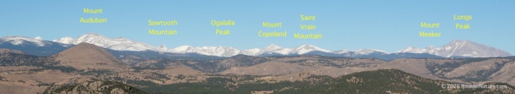
- Mount Audubon
- Sawtooth
- Ogallala Peak
- Mount Copeland
- Saint Vrain Mountain
- Mount Meeker
- Longs Peak (Rocky Mountain National Park)
On exceptionally clear days, Longs Peak stands prominently to the north.
📷 View this photo on Adobe Stock
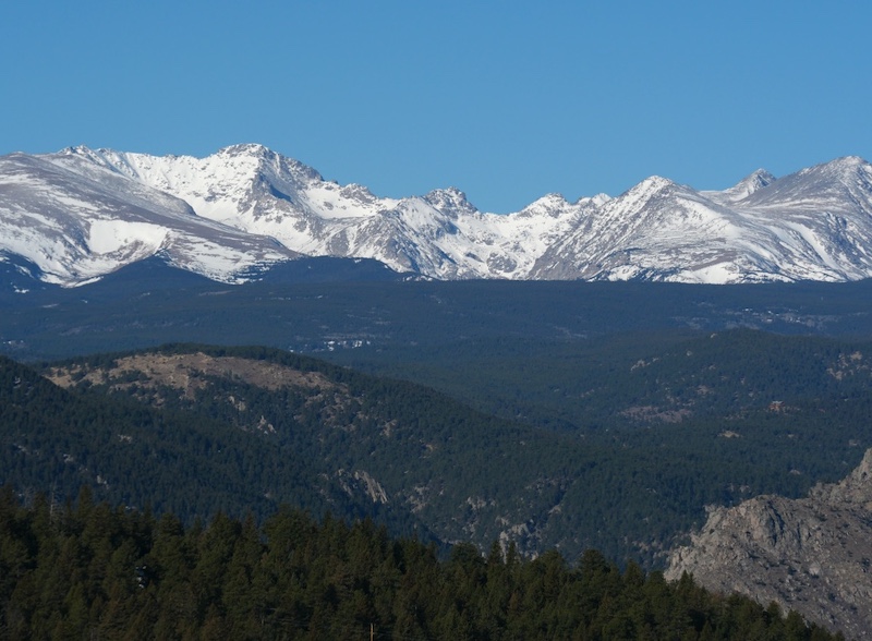
Geology: Why the Rocks Look Different
One of the interesting aspects of Lost Gulch is the contrast between the rocks beneath your feet and the distant peaks.
Lost Gulch Area
The exposed rocks around Lost Gulch are primarily ancient metamorphic rocks (gneiss and schist), formed approximately 1.7 billion years ago. These rocks make up part of Boulder’s Precambrian basement complex.
They often appear darker and show layered or banded structures.
Indian Peaks Wilderness
Many of the higher peaks in Indian Peaks are composed mainly of granite (such as Silver Plume Granite), formed around 1.4 billion years ago.
Granite tends to be lighter in color and forms massive, blocky summits.
This difference in rock type contributes to subtle variations in color, texture, and erosion patterns across the landscape.
Photography Tips
Lost Gulch is a popular location for:
- Sunrise photography
- Sunset and alpenglow
- Night sky photography
- Winter mountain views
Because access is easy, it is ideal for quick visits when mountain weather changes rapidly.
Bring sturdy footwear — the rocky surface can be uneven and slippery, especially in winter.
Why Visit Lost Gulch?
If you are looking for a dramatic mountain panorama without a long hike, Lost Gulch Overlook offers one of the best “effort-to-reward” ratios in Boulder.
Within minutes of leaving your car, you are standing on billion-year-old rock with sweeping views of Colorado’s high alpine peaks.
Related books
(Amazon US)

→ Explore more trails: Boulder Trail Index
This page is part of a growing local trail archive maintained by the YRAIN Project.